
|
|
 Dr. Gregory E. Tucker is an Associate Professor in the
Cooperative Institute for Research in Environmental Sciences (CIRES), and the Department of Geological Sciences, University of Colorado Boulder. He received his PhD in Geosciences from Pennsylvania State University in 1996. Hed did a postdoctoral fellowship at MIT, and was a fellow and lecturer at Oxford before joining the faculty in Boulder in 2004. He has too many publications and presentations at national and international conferences to even attempt to list here. He was awarded the Ralph Alger Bagnold Medal by theEuropean Geosciences Union, 2012.
Dr. Gregory E. Tucker is an Associate Professor in the
Cooperative Institute for Research in Environmental Sciences (CIRES), and the Department of Geological Sciences, University of Colorado Boulder. He received his PhD in Geosciences from Pennsylvania State University in 1996. Hed did a postdoctoral fellowship at MIT, and was a fellow and lecturer at Oxford before joining the faculty in Boulder in 2004. He has too many publications and presentations at national and international conferences to even attempt to list here. He was awarded the Ralph Alger Bagnold Medal by theEuropean Geosciences Union, 2012.|
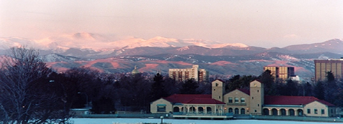
In a fast-paced world, it's reassuring to imagine that the one thing that never changes is the ground beneath our feet. But in fact, the land around us does change---sometimes so slowly that we scarcely notice, and sometimes so fast that it poses a major hazard. Meet geomorphology: the science of the earth's dynamic and evolving surface. An amazing collage of processes conspires to shape the terrain around us. Some of these include: weathering and weakening of rocks by water and plants, downhill movement of rock and soil by landslides, erosion of river beds by flowing water, and scour of enormous glacial valleys by moving ice. One of the goals of research in geomorphology is to understand each of these processes, ultimately to the extent that we can express them mathematically and build computer programs that simulate the gradual evolution of a landscape. The Colorado Front Range and the adjacent High Plains provide an great example of the dynamics of an changing landscape. When a mountain block like the Front Range begins to rise and slide, earth's erosion engine acts on it right away. Water and plants pry apart the bedrock, and chemically weak it. Rivers dissect the upthrust block of land into tree-like networks. If the mountains grow high enough, the rivers get help from glaciers. It is these networks of flowing water and ice, and not the tectonic forces themselves, that give the Rocky Mountains their famously jagged appearance. As slopes steepen, soil forms and begins to move downhill -- sometimes by a gradual process of creep, and sometimes in the form of dramatic landslides. All of these processes have acted together to give us the beautiful scenery of the Colorado Front Range. The prairie country east of the mountains has seen its share of geomorphic excitement too. When the mountains were growing, Colorado's eastern plains formed an enormous basin that caught much of the dirt, along with more than a few leaves and bones. The basin then went through times when the plains were gradually worn down, and times when they accumulated new layers of sediment. For about the past five million years, the Colorado's eastern plains have been in an erosion mode, with rivers like the Platte and the Arkansas carving vast but gentle "holes" across the prairie. In the process, these rivers and their tributaries sometimes left behind remnants of older, higher valley floors -- remnants that we can see today in broad mesas like Rocky Flats. An important part of the cycle of erosion across the dry plains is the incision, growth, and healing of networks of gullies. These gullies spring to life during summer storms, when flash floods race through them. In the excursion that accompanies this talk, we'll visit gullies and hillslopes at the Plains Conservation Center, and see evidence of the ongoing cycle of erosion. The PCC's West Bijou Site is providing valuable new data on gully erosion in a setting where it happens fast enough to measure. These measurements provide useful information for building and testing computer models, which offer the potential to help forecast erosion in other locations. |